BAGYO UPDATE #MaymayPH 🌀 5AM, August 5, 2026 Maymay…

0 reactions
BAGYO UPDATE #MaymayPH 🌀
5AM, August 5, 2026
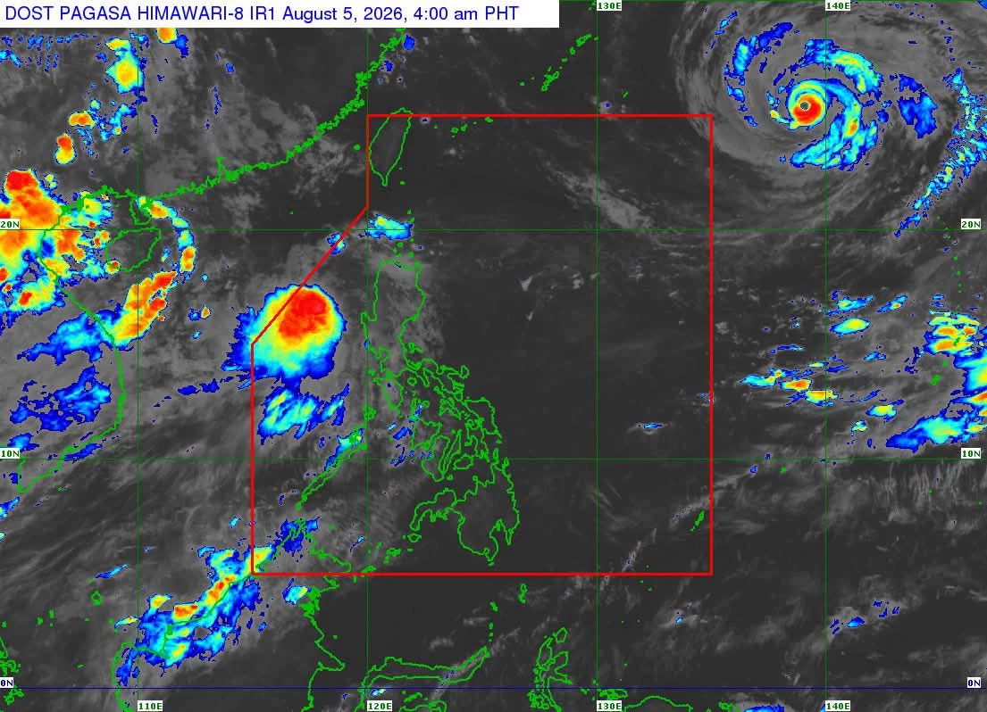
Maymay intensifies into a tropical storm.
At 4 a.m. Wednesday, the tropical storm was located 170 km west northwest of Bacnotan, La Union.
It has sustained winds of 65 kph witn gusts up to 80 kph and is moving southeastward slowly.
Wind signal no. 2 is now raised over
central and southern Ilocos Sur
northern and central La Union
northwestern Pangasinan
southwestern Abra
western Mountain Province
northwestern Benguet
Signal no. 1 is up over the rest of mainland Northern Luzon and parts of Central Luzon.
Maymay will move eastward and may make landfall over Ilocos Sur or La Union this afternoon or evening.
It will weaken while crossing Northern Luzon and may be downgraded into a low pressure area by Thursday afternoon or evening.
Maymay will bring signifcant rainfall over Central Luzon today and Northern Luzon until Thursday.
Southwest monsoon or Habagat will affect Southern Luzon and Western Visayas Wednesday and may extend over the entire Luzon from Friday.
The risk of flooding and landslides remains high across many areas in Luzon.
The public is advised to continue monitoring weather updates and take the necessary preparations. #WeatherPatrol
5AM, August 5, 2026
Maymay intensifies into a tropical storm.
At 4 a.m. Wednesday, the tropical storm was located 170 km west northwest of Bacnotan, La Union.
It has sustained winds of 65 kph witn gusts up to 80 kph and is moving southeastward slowly.
Wind signal no. 2 is now raised over
central and southern Ilocos Sur
northern and central La Union
northwestern Pangasinan
southwestern Abra
western Mountain Province
northwestern Benguet
Signal no. 1 is up over the rest of mainland Northern Luzon and parts of Central Luzon.
Maymay will move eastward and may make landfall over Ilocos Sur or La Union this afternoon or evening.
It will weaken while crossing Northern Luzon and may be downgraded into a low pressure area by Thursday afternoon or evening.
Maymay will bring signifcant rainfall over Central Luzon today and Northern Luzon until Thursday.
Southwest monsoon or Habagat will affect Southern Luzon and Western Visayas Wednesday and may extend over the entire Luzon from Friday.
The risk of flooding and landslides remains high across many areas in Luzon.
The public is advised to continue monitoring weather updates and take the necessary preparations. #WeatherPatrol


| 4,000 mlx | |
| 23 | |
| 0 |