
5 reactions
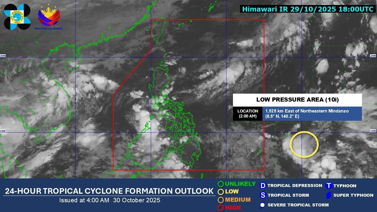
DOST-PAGASA begins monitoring the new Low Pressure Area (LPA 10i; US: Invest #98W ) located outside the Philippine Area of Responsibility (PAR) and currently has a LOW chance to develop into a tropical cyclone within the next 24 hours.
The current runs from the global models suggest that this disturbance may enter PAR this weekend and could threaten the Southern Luzon - Visayas area. Moreover, most of the models are now again picking up the possibility that the LPA may reach a typhoon category next week before its landfall in the mentioned areas.
However, since it is still beyond five (5) days, the uncertainty remains high. Again, we will update once the models are consistent in their upcoming runs.
The next PH storm name in the list is TINO.
Everyone is encouraged to continue monitoring the updates.
The current runs from the global models suggest that this disturbance may enter PAR this weekend and could threaten the Southern Luzon - Visayas area. Moreover, most of the models are now again picking up the possibility that the LPA may reach a typhoon category next week before its landfall in the mentioned areas.
However, since it is still beyond five (5) days, the uncertainty remains high. Again, we will update once the models are consistent in their upcoming runs.
The next PH storm name in the list is TINO.
Everyone is encouraged to continue monitoring the updates.


| 14,000 mlx | |
| 17 | |
| 5 |