
4 reactions
HISTORY OF SAMAR
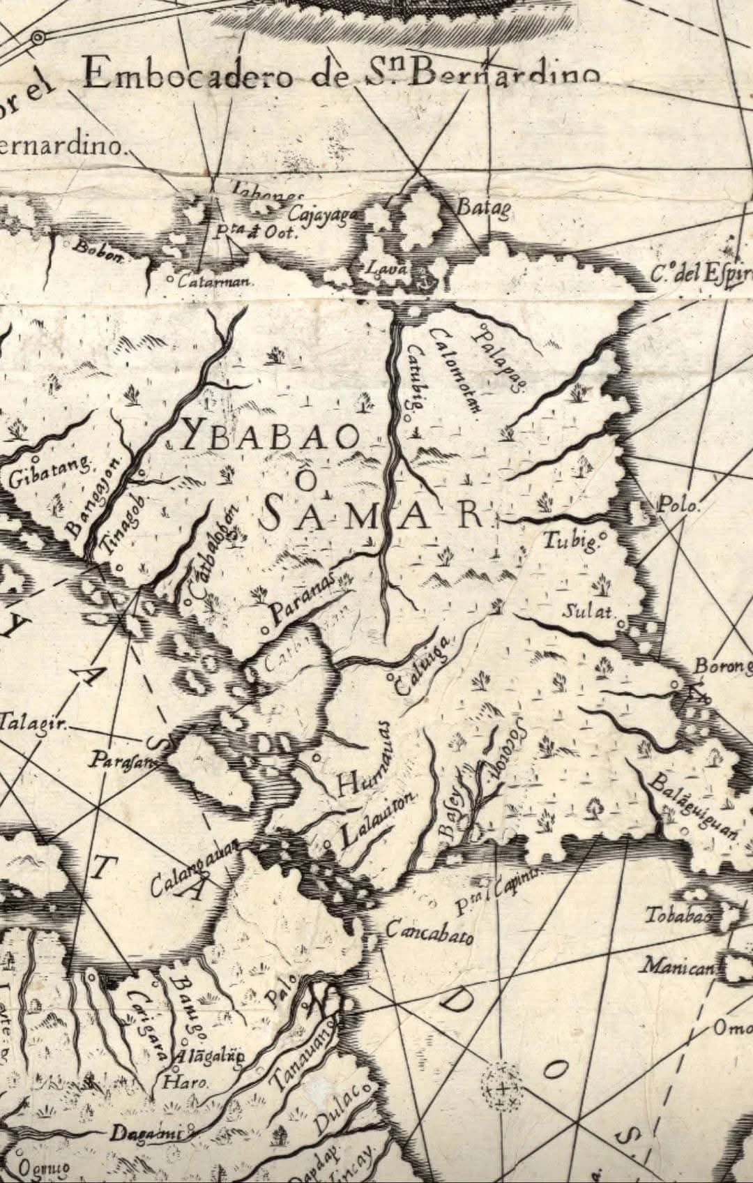
1734 Map of Samar, formerly called "Ibabao/Cibabao," "Samal," "Tandaya," etc Is your town on this map?
Prior to Spanish colonialization, Samar Island was called Samal, Ibabao/Cibabao, Tandaya, etc. Samar was derived from the local dialect "Samad," meaning wound or cut.
In the early days of Spanish occupation, Samar and Leyte islands were under the jurisdiction of Cebu. In 1735, a year after this map was made, Samar and Leyte were separated from Cebu and declared into one province with Carigara, Leyte as the capital.
Samar was separated from Leyte and declared as a province in 1768 with Catbalogan as the provincial capital.
History is amazing. Check if your town is already on this map. If not, what could be the reason?
Source: Murillo Velarde Map of 1734, Carta Hydrographica y Chorographica de las Yslas Filipinas, Library of Congress
1734 Map of Samar, formerly called "Ibabao/Cibabao," "Samal," "Tandaya," etc Is your town on this map?
Prior to Spanish colonialization, Samar Island was called Samal, Ibabao/Cibabao, Tandaya, etc. Samar was derived from the local dialect "Samad," meaning wound or cut.
In the early days of Spanish occupation, Samar and Leyte islands were under the jurisdiction of Cebu. In 1735, a year after this map was made, Samar and Leyte were separated from Cebu and declared into one province with Carigara, Leyte as the capital.
Samar was separated from Leyte and declared as a province in 1768 with Catbalogan as the provincial capital.
History is amazing. Check if your town is already on this map. If not, what could be the reason?
Source: Murillo Velarde Map of 1734, Carta Hydrographica y Chorographica de las Yslas Filipinas, Library of Congress


| 34,000 mlx | |
| 23 | |
| 4 |