
8 reactions
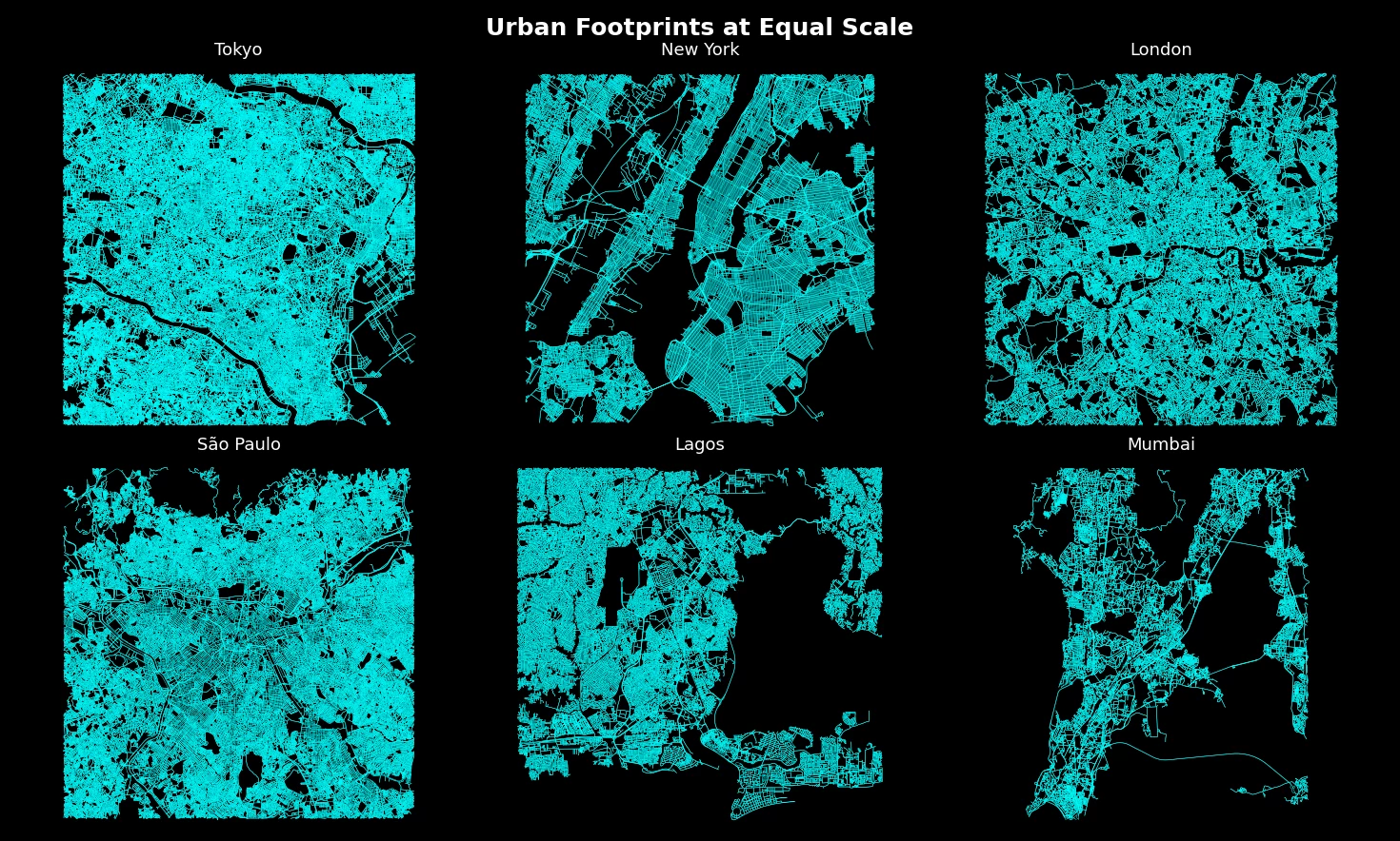
The road networks of the world’s biggest cities — each drawn at the same scale
Each panel shows a 7 km around the city center. All of them have the same zoom so you can compare each city. Each of those thin blue lines is a road
I’ve always been intrested by how a city’s layout reflects its history, like how NYC's planned boxy lanes date back to the 1700s, while newer cities exploded outward in a rush of population and growth.
Built entirely in python using OpenStreetMap data.
Have fun exploring it, mabye you will see your own city.
\[OC\]
#education
source
Each panel shows a 7 km around the city center. All of them have the same zoom so you can compare each city. Each of those thin blue lines is a road
I’ve always been intrested by how a city’s layout reflects its history, like how NYC's planned boxy lanes date back to the 1700s, while newer cities exploded outward in a rush of population and growth.
Built entirely in python using OpenStreetMap data.
Have fun exploring it, mabye you will see your own city.
\[OC\]
#education
source


| 13,000 mlx | |
| 16 | |
| 8 |