
0 reactions
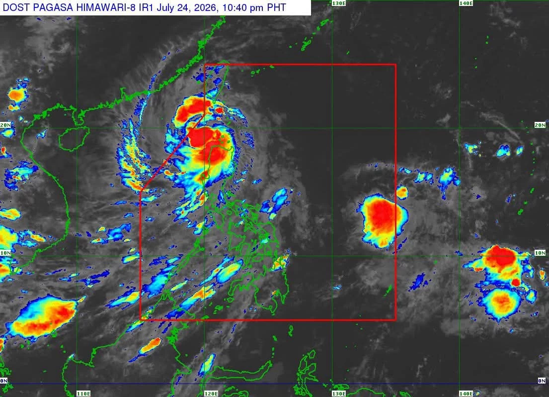
Several areas in Luzon remain under Tropical Cyclone Wind Signal No. 2 and 1, according to the 11 PM Tropical Cyclone Bulletin of PAGASA on Friday, July 24.
#KiyapoPH continues to intesify as it moves over the West Philippine Sea, the agency said.
Courtesy: PAGASA-DOST/X
Visit www.gmanetwork.com/news for more updates.
#KiyapoPH continues to intesify as it moves over the West Philippine Sea, the agency said.
Courtesy: PAGASA-DOST/X
Visit www.gmanetwork.com/news for more updates.


0 reactions
⚠️ ALERT: TROPICAL STORM ‘KIYAPO’ STARTS CROSSING NORTH OF CAGAYAN!
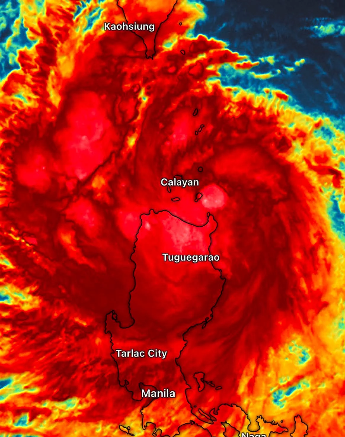
Tropical Storm #KiyapoPH {#NOUL} is beginning to cross the Babuyan Channel north of #Cagayan , bringing heavy rainfall across the Cagayan Valley.
Meanwhile, the rest of mainland #Luzon , including #MetroManila , will experience cloudy to rainy weather.
📸: Enhanced IR HIMAWARI-9 via Windy
#WeatherUpdate | 24 July 2026
Tropical Storm #KiyapoPH {#NOUL} is beginning to cross the Babuyan Channel north of #Cagayan , bringing heavy rainfall across the Cagayan Valley.
Meanwhile, the rest of mainland #Luzon , including #MetroManila , will experience cloudy to rainy weather.
📸: Enhanced IR HIMAWARI-9 via Windy
#WeatherUpdate | 24 July 2026
3 reactions
PHILIPPINES NOW COVERED IN CLOUD BANDS DUE TO TROPICAL STORM 'KIYAPO' AND SOUTHWEST MONSOON (HABAGAT) 🌀⚠️
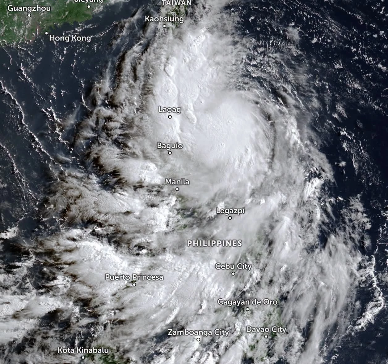
LOOK: Latest satellite imagery shows thick cloud bands covering a large portion of the Philippines as Tropical Storm #KiyapoPH (NOUL) continues to intensify the Southwest Monsoon (#Habagat) while heading toward #NorthernLuzon .
The cloud cover is thickest over #SouthernLuzon , #Visayas , and #Mindanao , where continuous rainfall is expected in the coming hours.
🌧 Expected weather across regions:
#NorthernLuzon – Rain and strong wind gusts caused by Tropical Storm KIYAPO.
#ZamboangaPeninsula, #Negros Island Region, Western Visayas, Lanao del Norte, BARMM, and SOCCSKSARGEN – Widespread rainfall caused by the enhanced Southwest Monsoon (Habagat).
#MetroManila, #CentralLuzon , #CALABARZON , #BicolRegion , #EasternVisayas , #Romblon , and #CentralVisayas – Cloudy skies with scattered to occasional rain showers due to the Southwest Monsoon (Habagat).
The public is advised to remain alert for potential flooding and landslides, especially in areas experiencing continuous rainfall.
#WeatherAlert #WeatherUpdate #KiyapoPH #Habagat | 24 July 2026
LOOK: Latest satellite imagery shows thick cloud bands covering a large portion of the Philippines as Tropical Storm #KiyapoPH (NOUL) continues to intensify the Southwest Monsoon (#Habagat) while heading toward #NorthernLuzon .
The cloud cover is thickest over #SouthernLuzon , #Visayas , and #Mindanao , where continuous rainfall is expected in the coming hours.
🌧 Expected weather across regions:
#NorthernLuzon – Rain and strong wind gusts caused by Tropical Storm KIYAPO.
#ZamboangaPeninsula, #Negros Island Region, Western Visayas, Lanao del Norte, BARMM, and SOCCSKSARGEN – Widespread rainfall caused by the enhanced Southwest Monsoon (Habagat).
#MetroManila, #CentralLuzon , #CALABARZON , #BicolRegion , #EasternVisayas , #Romblon , and #CentralVisayas – Cloudy skies with scattered to occasional rain showers due to the Southwest Monsoon (Habagat).
The public is advised to remain alert for potential flooding and landslides, especially in areas experiencing continuous rainfall.
#WeatherAlert #WeatherUpdate #KiyapoPH #Habagat | 24 July 2026

3