
3 reactions
PHILIPPINES NOW COVERED IN CLOUD BANDS DUE TO TROPICAL STORM 'KIYAPO' AND SOUTHWEST MONSOON (HABAGAT) 🌀⚠️
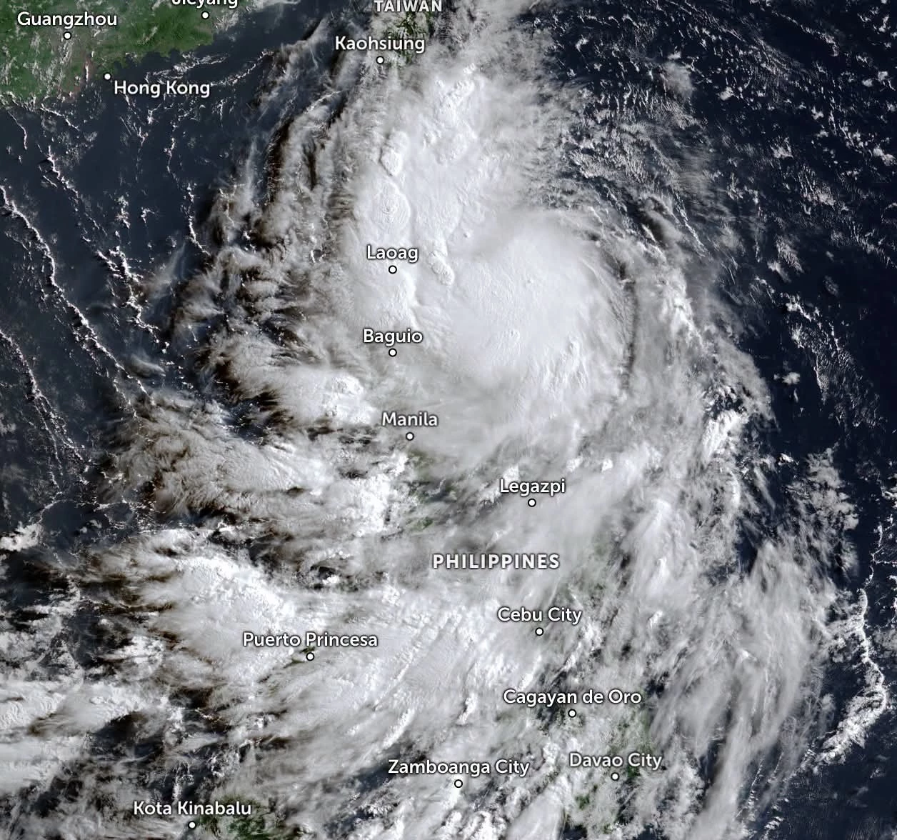
LOOK: Latest satellite imagery shows thick cloud bands covering a large portion of the Philippines as Tropical Storm #KiyapoPH (NOUL) continues to intensify the Southwest Monsoon (#Habagat) while heading toward #NorthernLuzon .
The cloud cover is thickest over #SouthernLuzon , #Visayas , and #Mindanao , where continuous rainfall is expected in the coming hours.
🌧 Expected weather across regions:
#NorthernLuzon – Rain and strong wind gusts caused by Tropical Storm KIYAPO.
#ZamboangaPeninsula, #Negros Island Region, Western Visayas, Lanao del Norte, BARMM, and SOCCSKSARGEN – Widespread rainfall caused by the enhanced Southwest Monsoon (Habagat).
#MetroManila, #CentralLuzon , #CALABARZON , #BicolRegion , #EasternVisayas , #Romblon , and #CentralVisayas – Cloudy skies with scattered to occasional rain showers due to the Southwest Monsoon (Habagat).
The public is advised to remain alert for potential flooding and landslides, especially in areas experiencing continuous rainfall.
#WeatherAlert #WeatherUpdate #KiyapoPH #Habagat | 24 July 2026
LOOK: Latest satellite imagery shows thick cloud bands covering a large portion of the Philippines as Tropical Storm #KiyapoPH (NOUL) continues to intensify the Southwest Monsoon (#Habagat) while heading toward #NorthernLuzon .
The cloud cover is thickest over #SouthernLuzon , #Visayas , and #Mindanao , where continuous rainfall is expected in the coming hours.
🌧 Expected weather across regions:
#NorthernLuzon – Rain and strong wind gusts caused by Tropical Storm KIYAPO.
#ZamboangaPeninsula, #Negros Island Region, Western Visayas, Lanao del Norte, BARMM, and SOCCSKSARGEN – Widespread rainfall caused by the enhanced Southwest Monsoon (Habagat).
#MetroManila, #CentralLuzon , #CALABARZON , #BicolRegion , #EasternVisayas , #Romblon , and #CentralVisayas – Cloudy skies with scattered to occasional rain showers due to the Southwest Monsoon (Habagat).
The public is advised to remain alert for potential flooding and landslides, especially in areas experiencing continuous rainfall.
#WeatherAlert #WeatherUpdate #KiyapoPH #Habagat | 24 July 2026


3

3 reactions
Unprecedented Flooding Grips Portugal 🇵🇹
A "train of storms" has pushed Portugal to its limit. The Mondego River has burst its banks near Coimbra, causing a section of the A1 motorway to collapse and forcing over 3,000 evacuations. With soils saturated and dams at capacity, authorities remain on high alert. Stay safe and avoid all non-essential travel in affected regions. 🌊⚠️
#PortugalFloods #Coimbra #StormLeonardo #WeatherAlert #PortugalNews
A "train of storms" has pushed Portugal to its limit. The Mondego River has burst its banks near Coimbra, causing a section of the A1 motorway to collapse and forcing over 3,000 evacuations. With soils saturated and dams at capacity, authorities remain on high alert. Stay safe and avoid all non-essential travel in affected regions. 🌊⚠️
#PortugalFloods #Coimbra #StormLeonardo #WeatherAlert #PortugalNews
1

1

7 reactions
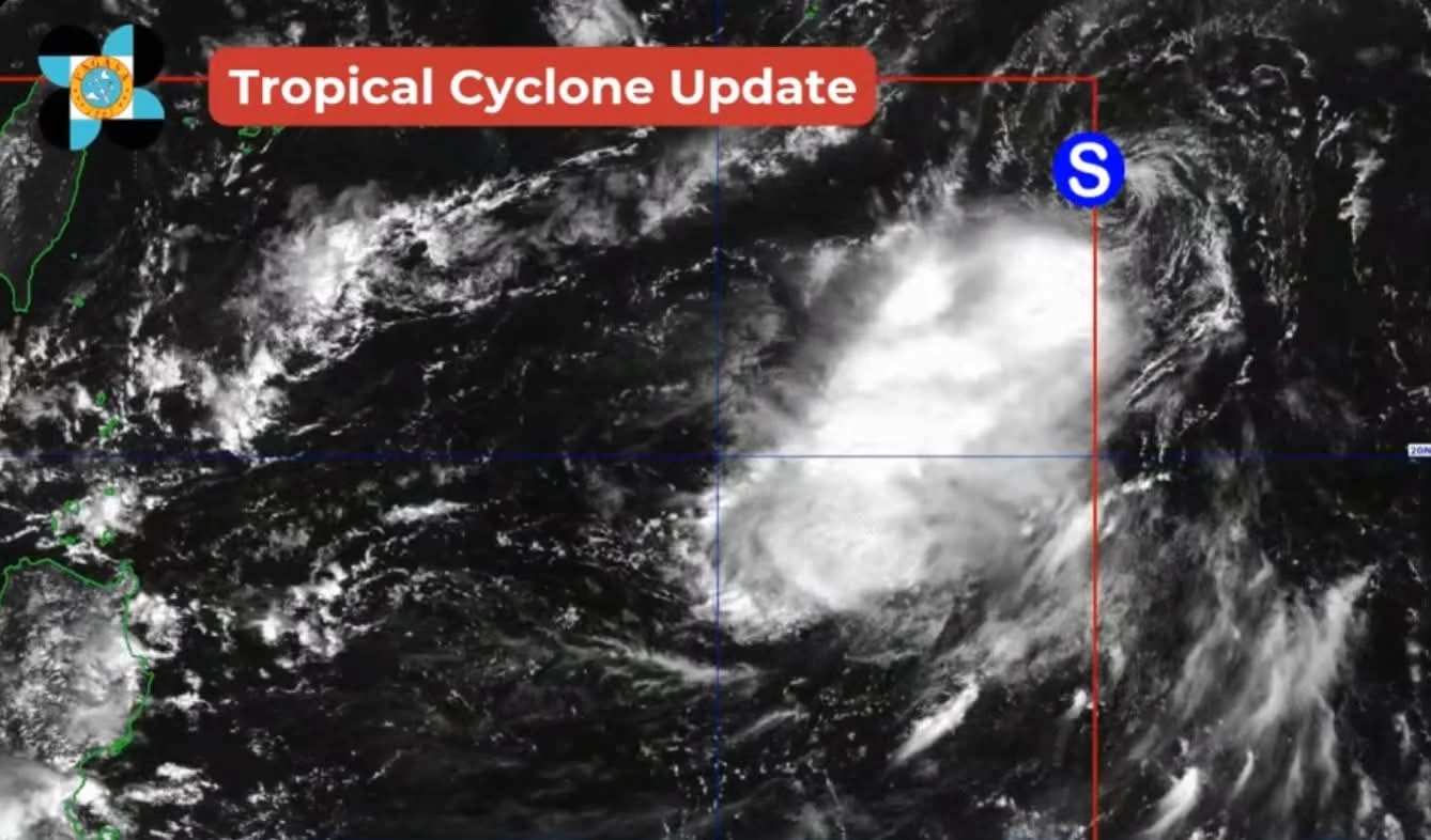
#WeatherAlert : PAGASA says Tropical Storm Nakri entered the Philippine Area of Responsibility at 12:40 pm on Thursday, October 9, 2025, and was given the local name Quedan. It is not expected to affect the country. #QuedanPH
7